District - North Baster , Kanker State- Chhattisgarh
About Kanker
The Kanker District is situated in the southern region of the state Chhattisgarh
Previously Kanker was a part of old Bastar district. But in 1998 Kanker got it's identity as an independent district.
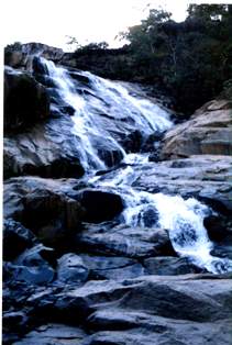
Kanker is situated within the longitudes 20.6-20.24 and latitudes 80.48-81.48. the total area of the district is 5285.01 square kilometers. Small hilly pockets are seen throughout the area.Mainly five rivers flow through the district namely- doodh river, Mahanadi, Hatkul river, sindur river and Turu river.
The Kanker is 140 kilometers away from Raipur and 160 Kilometers from Jagadalpur. A lot of Roadways and Private buses as well as taxis are available on this national Highway. Presently railway is not available in the district.
At present the Kanker district has 7 tehsils named Kanker, Charama, Narharpur, Bhanupratappur, Antagarh, Durgukondal and Pakhanjoor and 7 blocks named Kanker, charama, bhanupratapur, Narharpurn Antagarh, Durgukondal and Koyali beda. The total number of villages is 1004. The number of revenue villages is 995, whereas forest villages are 9.
District Profile
The Kanker lies between the two well developed cities of Chhattisgarh named Raipur (Capital of Chhattisgarh) and Jagdalpur.
The climate of the district is of Monsoon type. The May month is the hottest month and the December month is the coolest month. Average rain of the district is 1492 mm. 90% rain fall during the June to October. Climate changes in to dry and wet. Dry climate is found in Kanker and Charama and the wet climate is found in Bhanupratappur.